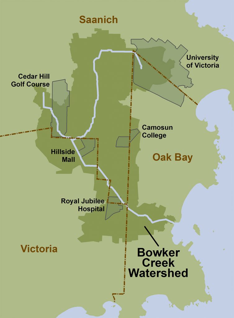
A watershed is the land area where all of the rainfall and snow melt within the area eventually ends up in the same creek, stream, or river. The Bowker Creek Watershed is the watershed that the majority of the UVic campus sits within. In fact, the headwaters of Bowker Creek lie on the west side of campus along the Alumni Chip Trail (see map linked below from the CRD). This means that a lot of the rain that falls on campus (and snow that melts), ends up in Bowker Creek. A map of the full watershed, including where the creek is culverted and where it is visible can be seen below. In total, the creek runs about 8km, with only 2.5km that is visible and not culverted underground. Throughout this project, I’ve been thinking about learning about this watershed in some way, and what better way to do it than to go on an adventure! The plan for this adventure is to travel the length of the Bowker Creek Watershed from the wetlands at UVic to the estuary and outlet of the creek into Oak Bay.
To make this plan a reality, a little bit of organizing has to happen. I need to:
- (Hopefully) Find some friends to do it with
- Learn a bit more about the watershed
- Plan a route
1. Find some friends
Anyone want to participate in this wonderful and wacky adventure? Let me know before the end of next week (October 24th). I haven’t decided how to travel through the watershed yet. I’m leaning towards running or walking. Biking could also work and would be a significantly smaller time investment, which at this point in the term is a serious consideration. I’m open to anything if others want to join in the fun.
2. Learn some more about the watershed
Bowker Creek lies within lək̓ʷəŋən territories. Prior to colonization, the creek and it’s tributaries ran through an extensive system of marshlands filled with Black Cottonwood trees and surrounded by Douglas Fir and Garry Oak ecosystems. Anadromous species like coho and chum salmon once spawned in the creek and provided an important food source for the lək̓ʷəŋən people. This is reflected in the name of a island near the mouth of the creek. What’s now commonly called Mary Tod or Jimmy Chicken Island, is known in lək̓ʷəŋən as Kohweechella, which means “where there are many fish”.
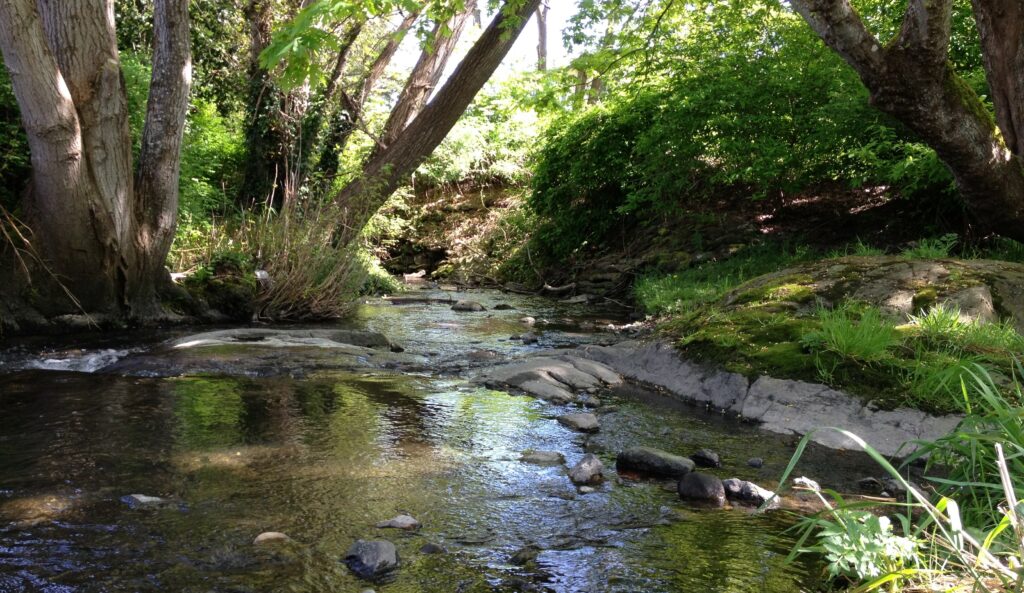
Today, much of the creek has been transformed by colonization, which led initially to agricultural development and more recently to extensive urban development. As of now, 70% of the stream is contained within underground culverts. Throughout the watershed, some of the rich terrestrial ecosystems that covered the landscape prior to colonization still exist. For example, Mt. Tolmie, which lies just south of UVic, has an intact Garry Oak ecosystem clinging to it’s slopes. The creek also hosts a limited number of freshwater larvae and worm species, but very few fish. Some fish are found at the mouth of the stream where it runs into Oak Bay, and this estuary is known as a great spot to observe many bird species.
Want to learn more? Check out these resources.
- Bowker Creek Urban Watershed Renewal Initiative
- Bowker Creek 10 year Achievements
- Friends of Bowker Creek Society
- Types of Ecosystems along Bowker Creek
- Surface Runoff and Pollution around Bowker Creek (StoryMap)
- Bowker Creek Watershed Map with Land Cover breakdown
- CRD Natural Areas Atlas (what watershed do you live in?)
- Watersheds: A Practical Handbook for Healthy Water
3. Plan a route
In total, I think that this will be about a 10km walk/run. It may also be a little bit longer if I end up biking because some of the trails might not be bike accessible. Below I’ve sketched out the route based on watershed maps like the one linked above. I used Google MyMaps to make this map and was able to copy code directly from MyMaps to enter into my WordPress Code Editor (a new skill for me!). Some of the trails that I know exist along the creek do not show up on Google Maps so the route is not entirely accurate but it’s close enough.
Leave a Reply
You must be logged in to post a comment.